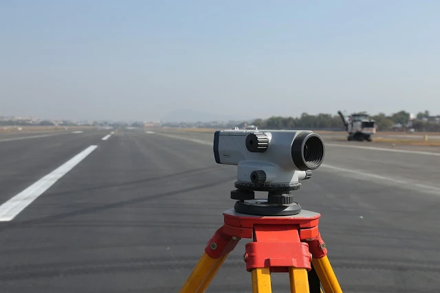
Introduction to Surveying
- Surveying is one of the oldest arts practised by man.
- It is believed that surveying had its origins in ancient Egypt.
- The introduction and practise of surveying is necessary for all branches of Engineering.
- Surveying is of special importance and interest to a Civil Engineer.
- Surveying is the starting point for any project or constructional scheme under consideration.
- Surveying may be defined as art to determine the relative positions of points on, above or beneath the surface of the earth, with respect to each other, by measurements of horizontal and vertical distances, angles and directions.
- Surveying may also be defined as the science of determining the position, in three dimensions, of natural and man-made features on, above or beneath the surface of the earth.
- The landform and its features may then be represented in analogue form as a contour map, plan, or chart, or in digital form as a three-dimensional mathematical model.
- A person performing such measurements is known as a Surveyor.
- Surveys are required prior to and during the planning and construction of buildings, dams, highways, railways, bridges, canals, tunnels, drainage works, water supply and sewerage systems, etc.
- Surveys may also be required for planning and construction of factories, assembly lines, jigs, fabrications, missile ranges, launch sites and mine shafts.
- There are two main categories of Surveying which are Plane Surveying and Geodetic Surveying.
- Plane Surveying deals with areas of limited extent and it is assumed that the earth's surface is a plane and therefore no corrections are necessary for the earth's curvature.
- Geodetic Surveying is concerned with determining the size and shape of the earth and it also provides a high accuracy framework for the control of lower-order surveys.
- Geodetic Surveys cover relatively large areas (such as a State or Country) for which the effects of earth curvature must be considered.
- The primary purpose of Surveying is to locate points of precise position on the earth's surface.
- The purpose of Surveying is to determine the dimensions and contours of any part of the earth's surface, that is, to prepare a plan or map, establish boundaries of the land, measure area and volume, and select a suitable site for an engineering project.
- Both plans and maps are graphical representations of the features on a horizontal plane.
- The plan is a large-scale representation.
- The map is a small-scale representation.
- When the topography of the terrain is depicted on the map with contours and spot levels, etc, it is called a Topographic Map.
- Surveying usually involves measurement, calculations, the production of plans, and the determination of specific locations.
- Surveying is classified as a learned profession because modern surveyor needs a wide background of technical training and experience and must exercise independent judgement.
- Knowledge of Surveying trains the ability of engineers to visualise, think logically and pursue the engineering approach.
- It promotes a feeling of confidence, a habit of working in groups, neatness and care in the documentation, and it also develops interpersonal relations by the ways of simultaneous and tactful handling of clients.
 |
| Introduction to Surveying |
*Self Typed
*Source- Internet, Books, Self-Analysis
